
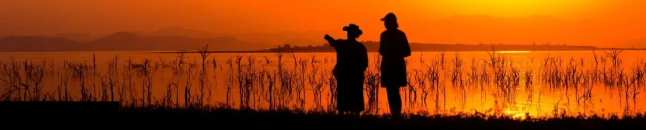
Cycling in the South of France – Part One
The Col du Tourmalet is not only the highest road in the central Pyrenees at 2,115 metres, but is also one of the most well-known of the climbs in the Tour de France, having been part of the route more than 70 times since 1919, and sometimes featuring more than once in the same Tour. No other climb in the Pyrenees has featured in more Tours and in 1974 one stage of the Tour actually finished at the top of the climb. The Col du Tourmalet has also featured in other famous cycle races, including the Vuelta a Espana.
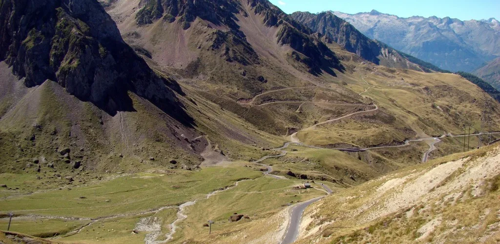
For this reason, the Col du Tourmalet was the very first Col that we decided to ride on our visit to the south of France. Our approach was to be from the eastern side, where the actual climb is 17.9 km long, gaining 1,268 m and with an average gradient of 7.4%. Averages, of course, can be misleading and the final few kilometres before reaching the top kick up to between 10% and 10.5%!

From the French, “Tour” translates into English as “trip”, and “mal” as “bad”, so it would be nice to believe, as some do, that Tourmelat means “Bad trip” in English. Unfortunately, it seems that the original derivation of the name is Gascony and not French, so the correct meaning is “the distant mountain” rather than “Bad trip”. Not nearly as pertinent for cyclists.
Leaving Bagneres de Bigorre, we cycled to the little village of Campan along a very pleasant road that was just gently uphill. In Campan we saw a variety of almost life-size mannequins on display in quite realistic poses. Some arranged at a table, apparently drinking tea, some chatting to each other, some sitting on balconies. Locally these are called “les Mounaques” and have their origins in an old tradition of mocking one of the residents, for example, an old man who has taken a young bride, by dressing up mannequins to look like him and setting them up around the village. Nowadays, of course, they are displayed for the benefit of tourists.

A little further on we reached the village of Sainte-Marie-de-Campan, which is located at the foot of the Col du Tourmalet. Sainte-Marie-de-Campan is etched into the history of the Tour because of an incident that took place here in 1913 and which is of sufficient interest to bear repetition. The rider Eugene Christophe was leading the Tour by an estimated 18 minutes when, as he was descending the Col du Tourmalet from the west, about 10 km above Sainte-Marie-de-Campan, the front forks of his bike broke. Riders had no support vehicles in those days and so he was alone on the road. Soon many of the riders who he had worked so hard to pull away from on the climb caught up and passed him. Carrying his bike, he walked the 10 km to Sainte-Marie-de-Campan, found a forge and was forced to weld his forks personally, as the rules of the Tour at that time forbade him from accepting any assistance. As it was, the race officials penalised him 10 minutes because he allowed a seven-year-old boy to pump the bellows for the forge while he welded his forks! The 10-minute penalty was later reduced and Christophe eventually finished the Tour in seventh place. How things have changed!

Incidentally, Christophe was also the first man ever to wear the maillot jaune when the yellow jersey was introduced in 1919, although he didn’t go on to win the race. Christophe was apparently not too happy with the idea of wearing yellow and complained that one of the spectators called out that he looked like a canary!
But for us, Sainte-Marie-de-Campan marked the start of the long climb to the top of the Col du Tourmalet and we set off with the intention of not stopping until we got to the top. Sainte-Marie-de-Campan lies at 847 metres above sea level; the top of the Col du Tourmalet is at 2,115 metres, so we were mindful of the task ahead.
This is a popular cycling route and signboards have been erected every kilometre from the foot of the climb to the top, showing the distance still to go before reaching the top, and also giving the average gradient for the next kilometre. This is a fabulous idea, which adds an extra dimension to the climb.
The first five kilometres after leaving Sainte-Marie-de-Campan are fairly easy, with gradients ranging from 2.4% to 7%, but thereafter there is no kilometre with a gradient averaging less than 8%.
The scenery and the views of the mountains are spectacular as the narrow road winds ever upwards and although there is quite a lot of traffic, including a variety of rather wide camper vans, we found the drivers courteous and patient. The road carries the painted names of many famous cyclists, painted by enthusiastic supporters at the time of the Tour. “Lance”, “Andy”, “Hagen”, “Hushovd” and dozens of others, some with national flags that added a touch of colour. It was a pleasant reminder that the road we were on had been traversed over the years by the very best cyclists in the world.

Moving upwards, we passed under a few “bridges” constructed to keep the road clear of snow and other slides, for this area is well above the snow line and is a very popular skiing area during the winter months. At about 1,800 metres above sea level, we passed through the village of Le Mongie, a winter ski resort that seemed deserted at this time of the year. Le Mongie has featured prominently in the Tour de France over the years and stages have finished in the village on three occasions, most recently in 2004 when the stage was won by Ivan Basso.

The last few kilometres before reaching the top of the Col du Tourmalet I found particularly tiring. It was quite hot by this time and as the gradient kicked up towards the end the kilometres seemed to stretch out a little.
This is a very popular cycling route in the summer months and we saw riders of all shapes, sizes, ages and abilities along the way. Many cyclists and more than a few support vehicles were gathered at the top of the climb when we finally got there. Many of the cyclists were immortalizing their visit by having their photographs taken at the sign marking the top of the Col, or next to the large silver statue of Octave Lapize, the first rider to reach the top on the first occasion that the Col featured in the Tour. Appropriately, this statue shows the rider gasping for air as he completes the climb.

The views from the top are spectacular, and looking back down at the winding road we had just ridden up emphasized the steepness of the gradient. This is also a popular walking area in the summer and the maze of trails disappearing into the mountains looked extremely inviting. From the top of the pass, a track can be seen leading off to the Pic du Midi de Bigorre observatory which is located higher up the mountain, at 2,877 metres.

We enjoyed a cup of tea at the well-patronized restaurant, then took an easy ride down to Bagneres de Bigorre. It was hardly necessary to turn the pedals on the descent and we enjoyed calling out a greeting to the riders still making their way to the top.

Recent Comments