
<< Back
14.04.2001
Day 26 : Saturday – From Southern Cross to Merredin (108.73 km)
 to Merredin (B)")
Southern Cross (A) to Merredin (B)
A very short day today, because of the distances between the towns, but very pleasant it was to complete a cycle by ten thirty! Almost like a rest day, really.
I left Southern Cross in the very early morning and cycled through the sleeping town in the freezing dawn. The roads were much quieter on this, the second day of the Easter weekend. Presumably those who had travelled away for the weekend were now safely ensconced at their destinations and would be returning only after the holiday break was completed.
The Great Eastern Highway led through several interesting settlements and roadhouses that, surprisingly, did not appear on our maps. On these same maps the roadhouses along the Eyre Highway across the Nullabor are mentioned by name, I guess because there is precious little else to mention on the Nullabor, but it seems that in this part of the world they don’t merit a mention, losing out to the more sizeable towns. Fickle people, cartographers.
The highway passed through very interesting scenery and I saw many flocks of galahs and Port Lincoln parrots, all incredibly noisy as they screeched to each other from the trees or as they took to the skies.
For the first time I was forced off the road and onto the verge by a speeding road train and was very lucky not to fall as the gravel was treacherously slippery. It was a close call and I felt quite shaken by the time I had brought the bike to a standstill. There was no logical reason for the road train to come in so close as it brushed past me, for there was no oncoming traffic at that point. I guess it could just have been a lapse of concentration of the part of the driver, but turned into a nasty moment for me.
It was a sunny, cloudless day and the early finish in Merredin, meant that I missed the heat and the stronger wind of the later morning. A pleasant day to be on holiday in Australia.

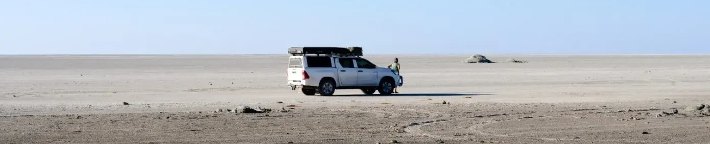
At our campsite
After a shower at the caravan park and a hearty breakfast at a nearby restaurant we walked into Merredin, which billed itself as The Heart of the Wheat Belt, in time to witness the annual Easter Parade. There were a few bonnets on show, but none that you would like to write a sonnet about. The parade consisted of a few floats and a group of children on their bicycles, but the streets were quite crowded and it was nice to see the support that was offered to those taking part.
There was an Easter gathering of veteran and vintage car enthusiasts spending the night at the caravan park, the majority of them arriving in the late afternoon. In spite of their obvious enthusiasm for their cars, which appeared to be matched only by their enthusiasm for socialising with their colleagues, we had a surprisingly quiet night.
15.04.2001
Day 27 : Sunday – From Merredin to Northam (161.25 km)
 to Northam (B)")
Merredin (A) to Northam (B)
It was another clear and windless morning when I emerged from the caravan park to start cycling. It was cool enough for a long sleeved top, but was not cold enough to be unpleasant. I took off through the quiet streets of Merredin.
At the edge of town there was a roadside board commemorating the assembly site of the longest road train in the world. Six hundred and ten metres long, it was, and was made up of forty-five trailers. It was driven for some eight or nine kilometres down this very stretch of road. My mind struggled to get around the nightmare of meeting up with a road train well over half a kilometre long while cycling quietly along a country road. A little further on a signboard restricted the length of road trains using the Great Eastern Highway to a more reasonable thirty-six and a half metres.
The Great Eastern Highway passes some low-lying, waterless “lakes” that, in South Africa, would be called pans. The Hines Lakes and a bit further on the Baandee Lakes, clearly pointed to the occasional presence of surface water, although there was none at the moment. As we approached Northam we also passed over a few creeks, also waterless at present, but the first creeks that we had seen for the longest time.
Some sixty kilometres from Merredin I reached Kellerberrin, which turned out to be quite a sizeable settlement, with an attractive looking caravan park. This evoked a short-lived regret at not having pushed on from Merredin, to spend the night at Kellerberrin instead.
I also passed through Tammin, Cunderdin and several other small settlements, many staking some claim to fame. “The Earthquake Capital of Australia” proclaimed one. Another featured a photographic museum housed in a building decorated to look like a camera, with the entrance being via the lens. Some of these settlements bore the quaintest of names: Doodlakine, Wyalkatchem and Grass Valley.
By this stage of the trip I found that I was very tired towards the end of each day’s cycle, although I was fine for the first half. I was surprisingly free of any specific aches or pains. My behind was tender from the hours on the narrow saddle and I had some really minor chaffing between my legs, but otherwise I felt that I was in pretty good condition.
16.04.2001
Day 28 : Monday – From Northam to Moora (169.14 km)
 to Moora (B)")
Northam (A) to Moora (B)
 to Moora (B)")
Northam (A) to Moora (B)
Off the highways and onto the byways for today’s ride and what a pleasure it was. I left Northam shrouded in the thick mist that filled the morning’s first light. As I exited the caravan park I noticed a hot air balloon hovering eerily over the town. As always, with the amount of lift dependant on the temperature differential between the air in the balloon and that outside the balloon, the balloonists were forced to make an early start. Sadly for them, the mist would have obscured the wonderful views from the quietly drifting airship.
I passed through the sleeping town and crossed over the Avon River, the first sizeable river we had crossed since leaving New South Wales, famous for the white swans that were brought here from England way back in the late 1800s. In a state that has a black swan as its emblem, white swans are apparently something of which to be proud. A short way beyond the Avon I turned onto the road to Toodyay, a road that very quickly turned into one of the highlights of the trip. The hills were suddenly much steeper now that we were off the highway, which made me think, once again, that the superior contouring was for the benefit of the road trains. The incredible scenery was more than adequate compensation for the tougher cycling conditions. Rolling hills covered with trees; conservation areas of indigenous vegetation; and fascinating farms. A merino stud, an alpaca stud, a miniature horse stud, magnificent cattle farms. Wait! Alpacas in Australia? Well, yes. Seriously. I saw them. Alpacas! In the conservation areas we saw kangaroos, (or are they wallabies?) and emus in the forests adjacent to the road. What a wonderful area in which to cycle!

A wonderful area in which to cycle
Just twenty-five kilometres from Northam I reached the village of Toodyay, a village that I felt I could settle in right there and then. A small town full of character with fascinating buildings and a cemetery with separate sections set aside for Catholics, Anglicans, Methodists and members of the Uniting Church. Even a small section for Seventh Day Adventists. There were many roadside signs imploring passers-by to support a campaign to keep road trains out of the area, which was a sentiment that I, as an outsider revelling in the rural setting, sympathised with entirely.
The magnificent scenery continued after I left Toodyay and headed down the road to Bindoon and I idly speculated that this could be my regular Sunday morning ride if I lived in Toodyay. What a pleasure! Just how I would occupy the balance of the week seemed totally unimportant at that time.
The road from Toodyay joined the Great Northern Highway and I headed south for a few kilometres before turning west once again and taking the road to Gingin. A few kilometres further on we changed our pre-planned route for the first time since setting out from Ballina. Instead of pushing on to Gingin and then taking the Brand Highway northwards as planned, Jane, who had been studying the maps rather carefully, suggested that we take the 116 road north to Moora. This more scenic route would give us an overnight stop at an appropriate cycling distance, a suitable stop not being obvious on the Brand Highway route.
The scenic route. For scenic read hilly. For hilly read mostly uphill. It was very hot by this time, aggravated by the fact that there was not a breath of wind, and in spite of the magnificent scenery I was growing very tired as the hills took their toll. We stopped for a lunch of sandwiches after I had covered one hundred kilometres and found ourselves near the gate to a farm with four or five very impressive bulls just across the fence, seemingly as interested in us as we were in them. Just sitting in this idyllic rural farm setting, watching the animals and the mid-morning farmyard activity made up for the hills I’d had to climb to get here.
Fortunately the road levelled off shortly after our lunch stop as it crossed the Victoria Plains and I was able to speed up a little in spite of the heat and my tired legs.
The caravan park at Moora was rather different. It is part of a public park and the facilities are used by members of the public as well as the patrons of the caravan park itself. There is no curator at the park and a rather strange honesty system of paying for your site that entails putting the stipulated fee into an envelope and posting it into a deposit box.
Moora had been devastated by floods during 1999 and we were fascinated by the steps that the local authorities had taken to ensure that the disaster could not be repeated. Building regulations had been changed and money made available for folk to raise their houses on pillars to prevent future flooding. There was even talk of building a system of weirs to better control the level of the river.
<< Back
>> Part Eight
Recent Comments